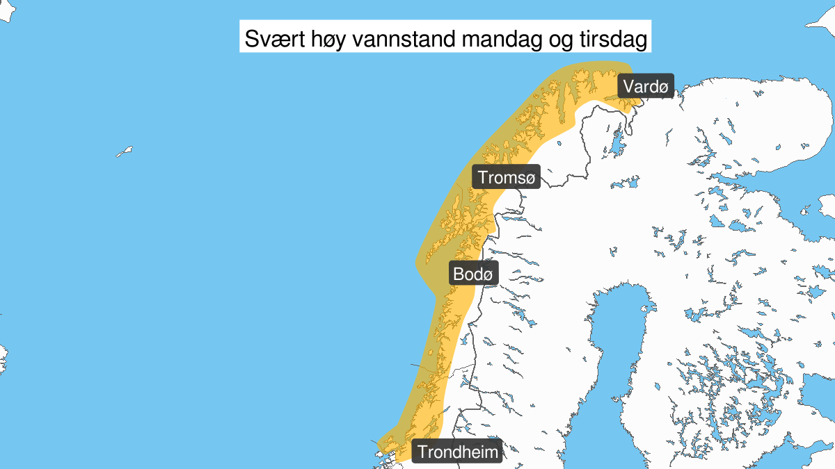
Warning from MET Norway for Helgeland, Salten, Ofoten, Lofoten, Vesteraalen, Sør-Troms and Nord-Troms
3
Very high water level, orange level (MET)
Published:
Valid:
from 10.02.2020 11:00
to 11.02.2020 20:00
Warning
Water level at the coast and in the fjords
-
Sender: MET Norway
-
Danger ongoing: Monday, February 10, 2020, kl.11:00 AM
-
Danger decrease: Tuesday, February 11, 2020, kl. 8:00 PM
-
Certainty: Likely > 50%
Name
Elsa
Consequence
Flooding and risk of moderate damage to infrastructure and buildings in the coastal zone.
Advice
Check the mooring of the boat and secure objects inside boathouses and in the coastal zone.
Description
Forecast for the area Roervik to Loppa: Monday afternoon to Tuesday evening very high water level is expected, estimated to 65-80 cm above the height given in the tide tables. The water level is expected at its highest around 12-15 in the afternoon and 00-03 at night. More information about tides and water level at sehavniva.no More informasjon about tide and water level can be found at sehavniva.no