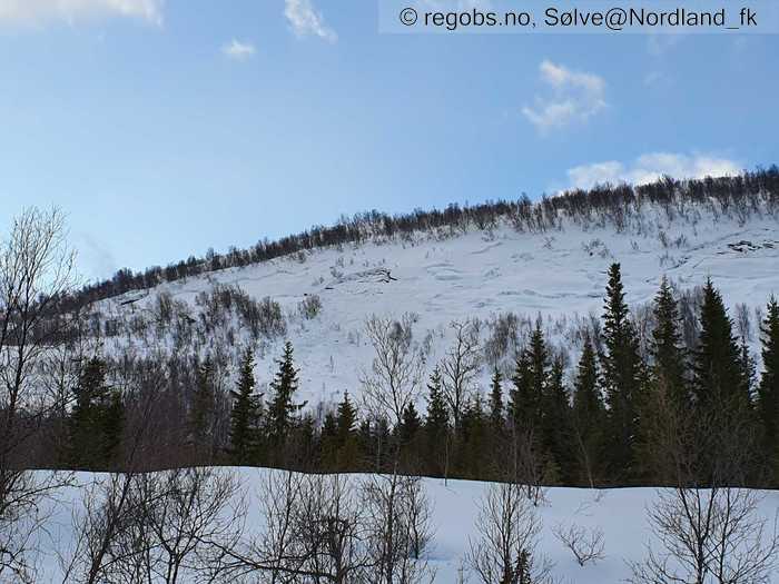
Image 1 of 9 Of: Avalanche Activity Copyright: Sølve@Nordland_fk
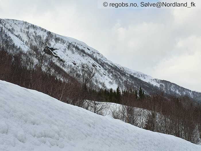
Image 2 of 9 Of: Avalanche Activity Copyright: Sølve@Nordland_fk
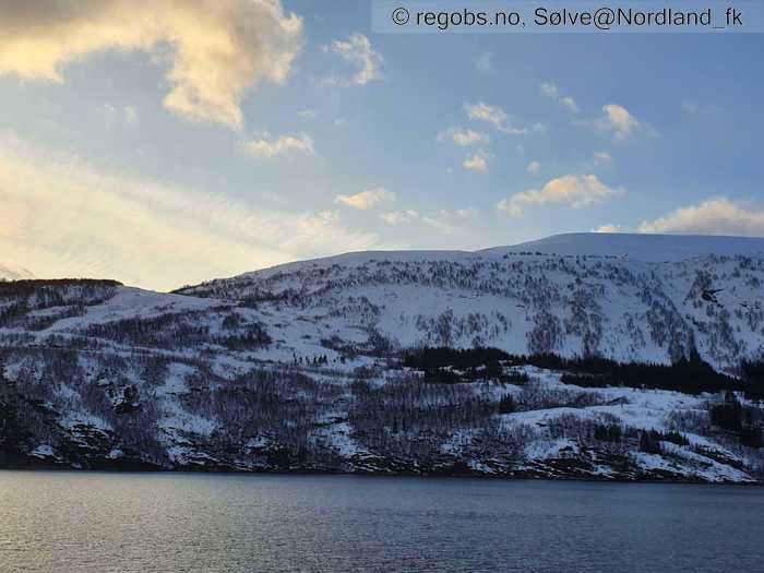
Image 3 of 9 Of: Weather Copyright: Sølve@Nordland_fk
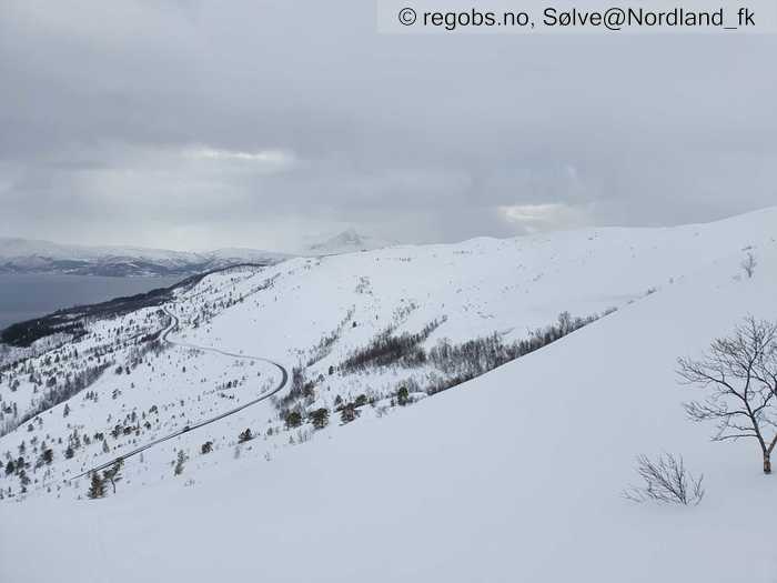
Image 4 of 9 Of: Weather Copyright: Sølve@Nordland_fk
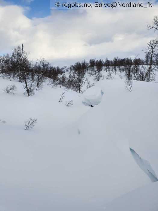
Image 5 of 9 Of: Snow Cover Copyright: Sølve@Nordland_fk
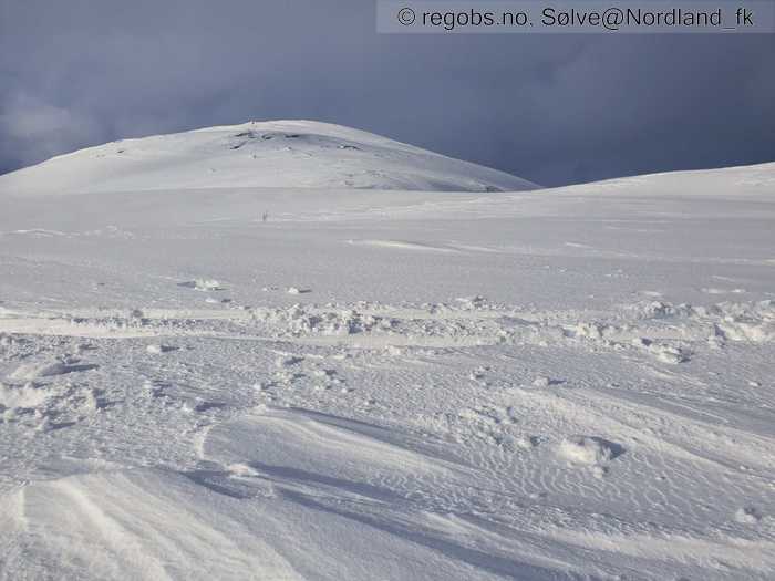
Image 6 of 9 Of: Snow Cover Copyright: Sølve@Nordland_fk
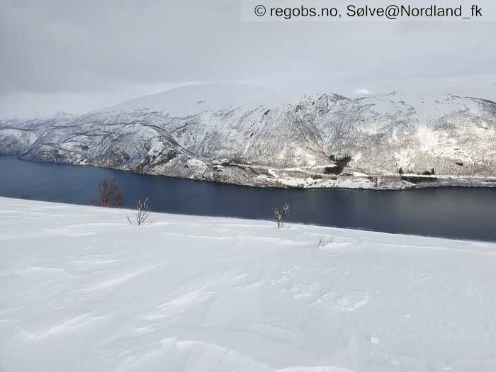
Image 7 of 9 Of: Snow Cover Copyright: Sølve@Nordland_fk
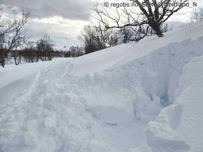
Image 8 of 9 Of: Tests Copyright: Sølve@Nordland_fk
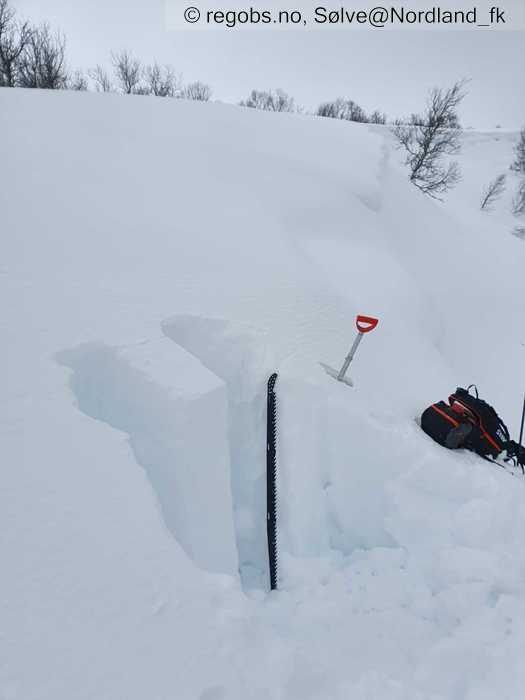
Image 9 of 9 Of: Tests Copyright: Sølve@Nordland_fk
Avalanche Activity
• 17. Apr. During the day • Loose wet avalanche • Numerous (10 or more). 1 - Small. Spontaneous release • Some steep slopes. N, NE, E, SE, S, SW, W, NW. Below 400 masl • Regn, sol og plussgrader har gitt endel små våte løssnøskred i lavlandet. Det har også vært en del glideskred-aktivitet de siste dagene, men det virker ikke som det har vært så mye aktivitet i dag.
Weather
• Snow • -0.5 °C • 5 m/s from NW ↘ • 80% clouds • Bygevær, litt regn i lavlandet. Akkurat nok vind til å flytte litt snø langs bakken. Klarner opp utpå kvelden.
Snow Cover
• Some snow drift • Elevation of new snow 200 masl • Much loose snow (10-30cm) • Dry • Over skoggrensen er det 20-30 cm lett bundet snø i leformasjoner. På mer vindeeksponerte rygger er er skisporene 5-10 cm dype. Det er mye snø i fjellet. Opp til 600 meter er snødekket mellom -0,4 til 0 grader. Det er ikke registrert svake lag og heller ikke islag eller lignende som vil skape opphopning av vann.
Tests
• LBT@80cm(Q3) • Ved stor belastning vagger søylen i overgang mellom fokksnø og smelteomvandlet snø. Det virker som det er god stabilitet i fokksnøen. Det kan nok være ustabile flak enkelte steder i høyden.
Snow Profile
• Søkestangen gikk ikke til bakken. • 6 Stratigraphy layers • 9 temperature points observed
Avalanche Problems
• Dry slab avalanche • Buried weak layer of new snow • Within half a meter • The weak layer collapses easily and clean (easy propagation). The overlying slab is soft. • Easy to trigger • 2 - Medium • Some steep slopes NE, E, SE, S, SW above 600 masl • Har ikke vært i denne høyden men antar det kan være et problem.
• Loose wet avalanche • Loose snow • Spontaneous release • 2 - Medium • Some steep slopes E, SE, S, SW, W below 600 masl
Avalanche Danger Assessment
• Lagdelingen i snødekket opp til 600 meter virker gunstig. Fokksnøen har gode bindinger under denne høyden. I høyden er det ventet at det er noen utsatte heng. Våte løssnøskred kan nok være et problem i lavlandet og sørlig eksposisjon, men den ferske snøen i lavlandet er oppbløtet så det skal kanskje litt varmere vær/mer regn til enn det var i dag for å gi særlig utslag. • 2 Moderate

