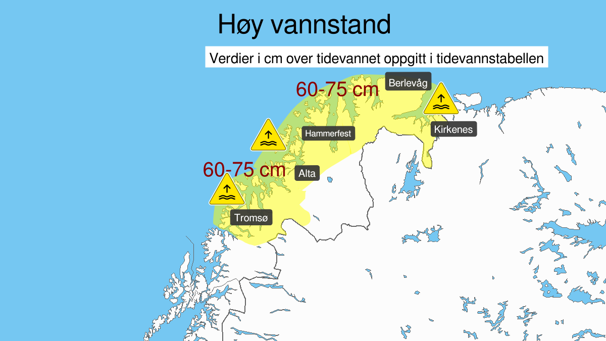
Warning from MET Norway for Nord-Troms and Kyst- and fjordstroekene i Finnmark
2
High water level, yellow level (MET)
Published:
Valid:
from 09.01.2020 10:00
to 09.01.2020 20:00
Warning
Water level at the coast and in the fjords
-
Sender: MET Norway
-
Danger ongoing: Thursday, January 9, 2020, kl.10:00 AM
-
Danger decrease: Thursday, January 9, 2020, kl. 8:00 PM
-
Certainty: Likely > 50%
Consequence
Local flooding and risk of minor damage to infrastructure and buildings in the beach zone.
Advice
Be careful in coastal areas. Check the mooring of the boat and secure objects near the water in the coastal zone.
Description
Forecast for route Hekkingen-Russian Border: Thursday it is expected high water level in Troms and Finnmark, estimated to 60-75 cm above values given in the tide tables, in combination with high waves. The water level is expected to be at its highest Thursday afternoon.