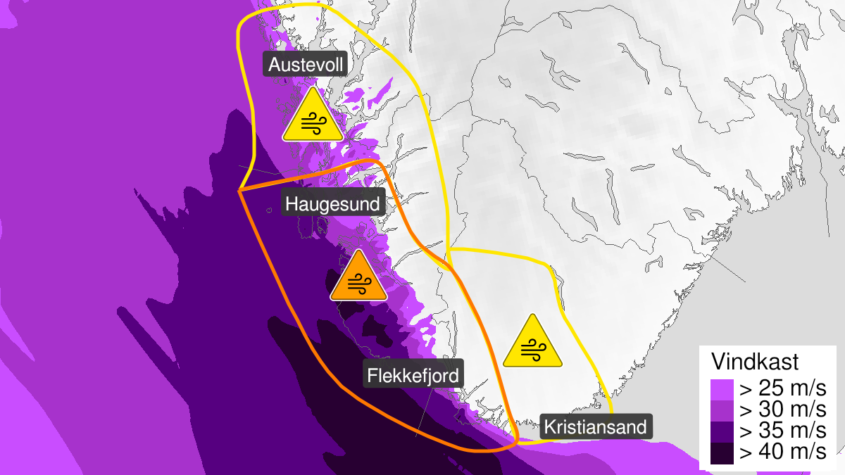
Warning from MET Norway for Parts of Rogaland and west in Agder
3
Possibility of extremely strong wind gusts, orange level (MET)
Published:
Valid:
from 21.12.2023 13:00
to 22.12.2023 00:00
Warning
Wind gusts
-
Sender: MET Norway
-
Danger ongoing: Thursday, December 21, 2023, kl.1:00 PM
-
Danger decrease: Friday, December 22, 2023, kl. 12:00 AM
-
Certainty: Possible < 50%
Consequence
Expect cancelled departures for ferry, plane, or other transport. Bridges may be closed. Allow a lot of extra time for transportation and driving, even for short journeys. Many roads may be closed due to trees or other objects. Blowing snow at higher altitudes causes reduced visibility. Expect convoys and/or closed roads. Blowing snow causes reduced visibility and possibly convoys and/or closed roads. High waves may cause damage to infrastructure and buildings in the coastal zone. The strong wind may cause locally high waves in fjords and lakes.
Advice
Follow the advice of emergency authorities. Follow advice and check status from transport operators. The need for emergency preparedness shall be assessed continuously by emergency response actors. Be careful in coastal areas. In advance consider measures to limit damage.
Description
Thursday afternoon and evening locally extremely strong wind gusts around 33-45 m/s are expected from northwest, and hurricane force 12 at the coast. The strongest gusts are expected near the coast and at Jæren. The wind is expected to decrease from late Thursday evening, first in the north.