Warning from MET Norway for Nordbank, Nordkappbank, Hjelmsoybank, Tromsoflaket, Banks outside Troms, Vesteraalsbanks, Parts of Finnmark, Parts of Troms, Parts of Vesteraalen, Parts of Lofoten.
2
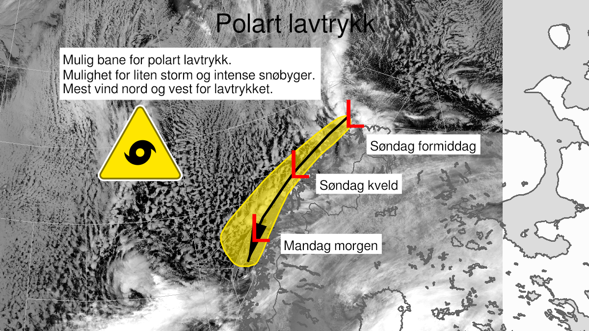
Polar low, yellow level (MET)
Published:
Valid:
from 14.01.2024 11:00
to 15.01.2024 07:00
Warning
Polar low
-
Sender: MET Norway
-
Danger ongoing: Sunday, January 14, 2024, kl.11:00 AM
-
Danger decrease: Monday, January 15, 2024, kl. 7:00 AM
-
Certainty: Likely > 50%
Consequence
Abrupt change in wind speed and wind direction. Some journeys may have longer travel time. It can be locally difficult driving conditions due to heavy snowfall in combination with wind.
Advice
Be aware of abrupt weather changes. Avoid unnecessary journeys to exposed places. Check road reports (175.no). Use tires fit for winter conditions and use caution while driving.
Description
A Polar Low is now located on the North bank north for Finnmark at the position N71'20 E028'35. The low is moving southwestward along the coast and is expected to landfall at 15 January at 07 local time in the area Lofoten, Vesteraalen or Southern part of Troms. There is expected occasionally north and northwest gale force 8 and possibly severe gale force 9 in conjunction with the low. Strongest wind will occur north and west of the low. There are also expected intense snow showers in conjunction with the Polar Low with locally 10-25 cm within 6-12 hours. The snow showers are expected to appear further inland compared to the strongest wind. The low is expected to dissipate Monday morning.