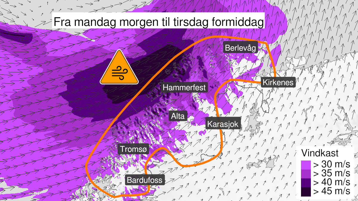
Warning from MET Norway for Troms og Finnmark
3
Possibility of extremely strong wind gusts, orange level (MET)
Published:
Valid:
from 29.01.2024 05:00
to 30.01.2024 07:00
Warning
Wind gusts
-
Sender: MET Norway
-
Danger ongoing: Monday, January 29, 2024, kl.5:00 AM
-
Danger decrease: Tuesday, January 30, 2024, kl. 7:00 AM
-
Certainty: Possible < 50%
Consequence
Larger loose items may be taken by the wind. Cancelled departures for ferry, plane, or other transport expected. Bridges may be closed. Many journeys may have longer travel times. Blowing snow causes reduced visibility and possibly convoys and/or closed roads. High waves may cause damage to infrastructure and buildings in the coastal zone.
Advice
Secure all loose objects. Avoid exposed places. Allow a lot of extra time for transportation and driving. Follow advice and check status from transport operators. Check road reports (175.no). Be careful in coastal areas.
Description
Locally very strong gusts of 35-45 m/s is expected from southwest and west, possibly extreme gusts over 45 m/s. The strongest winds are expected in coastal areas of Troms and West Finnmark with storm force 10 to 11, and risk of hurricane force 12 at the coast. In inner regions gusts up to 30-33 m/s is expected, with possibly gusts of over 35 m/s. The wind will increase first in Troms, and decrease last in East Finnmark.