Warning from MET Norway for Troendelag and Helgeland
3
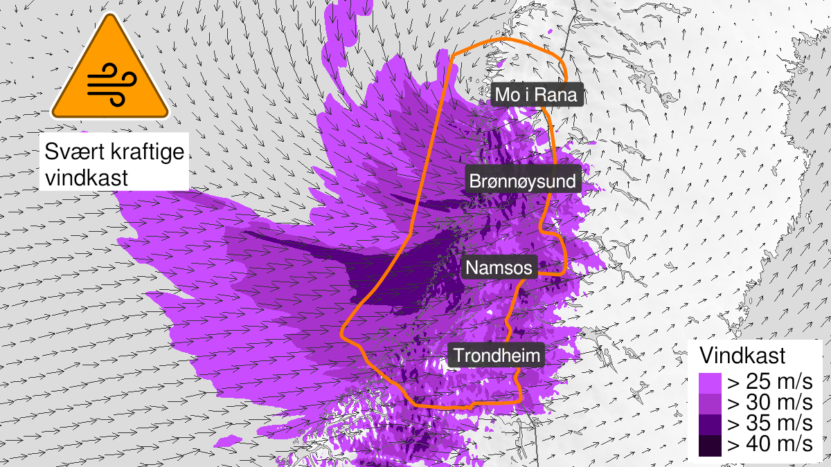
Very strong wind gusts, orange level (MET)
Published:
Valid:
from 03.02.2024 11:00
to 03.02.2024 21:00
Warning
Wind gusts
-
Sender: MET Norway
-
Danger ongoing: Saturday, February 3, 2024, kl.11:00 AM
-
Danger decrease: Saturday, February 3, 2024, kl. 9:00 PM
-
Certainty: Likely > 50%
Consequence
Larger loose items may be taken by the wind. Risk of damage to buildings and infrastructure. Cancelled departures for ferry, plane, or other transport expected. Bridges may be closed. Many journeys may have longer travel times. The power supply will be impacted, due to tree(s) falling over. Roads may be closed due to trees or other objects in the road. Blowing snow causes reduced visibility and possibly convoys and/or closed roads. High waves may cause damage to infrastructure and buildings in the coastal zone. The strong wind may cause locally high waves in fjords and lakes.
Advice
Secure all loose objects. Avoid exposed places. Allow a lot of extra time for transportation and driving. Consider whether the journey is necessary. Follow advice and check status from transport operators. Check road reports (175.no). The need for emergency preparedness shall be assessed continuously by emergency response actors. Be careful in coastal areas. In advance consider measures to limit damage.
Description
Locally very strong gusts at 35-43 m/s are expected from west, and violent storm on the coast. Wind gusts of 30-35 m/s are expected in inland areas. The wind will increase first on the coast.