Warning from MET Norway for Lofoten, Vesteraalen, Troms and Kyst- and fjordstroekene i Vest-Finnmark
2
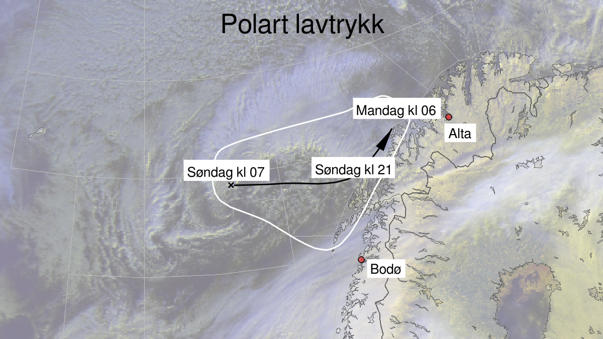
Polar low ongoing, yellow level (MET)
Published:
Valid:
from 15.03.2020 21:00
to 16.03.2020 08:00
Warning
Polar low
-
Sender: MET Norway
-
Danger ongoing: Sunday, March 15, 2020, kl.9:00 PM
-
Danger decrease: Monday, March 16, 2020, kl. 8:00 AM
-
Certainty: Observed - 100%
Consequence
Abrupt change in wind speed and wind direction. It can be difficult to navigate due to snow, blowing snow and reduced visibility. Some journeys may have longer travel time. It can be locally difficult driving conditions due to heavy snowfall in combination with wind.
Advice
Be aware of abrupt weather changes. Avoid unnecessary journeys to exposed places. Consider whether the journey is necessary. Check road reports (175.no). Use tires fit for winter conditions and use caution while driving.
Description
A Polar Low is now at 70N 008E. It is moving in east direction and is 20 UTC Sunday evening expected to make landfall at Vesterålen. On Sunday evening a northwest severe gale force 9 is expected from Skomvær to Fruholmen.