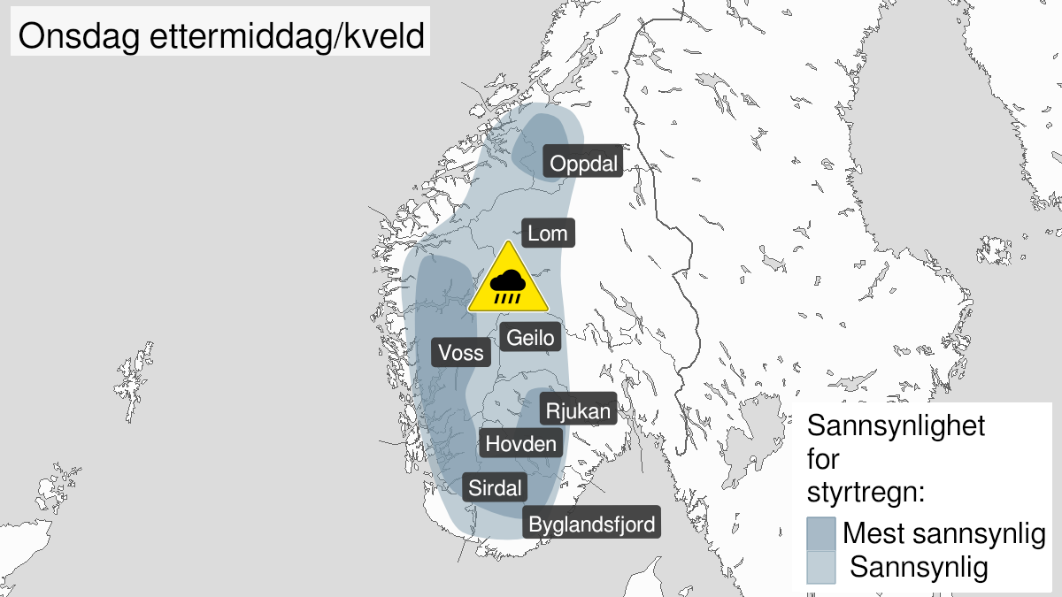
Warning from MET Norway for Trøndelag
2
Heavy rainshowers, yellow level (MET)
Published:
Valid:
from 17.06.2020 14:00
to 17.06.2020 20:00
Warning
Rain flood
-
Sender: MET Norway
-
Danger ongoing: Wednesday, June 17, 2020, kl.2:00 PM
-
Danger decrease: Wednesday, June 17, 2020, kl. 8:00 PM
-
Certainty: Likely > 50%
Consequence
Risk of storm water in urban areas, local flooding, stream bank erosion, changing waterways, shallow landslides at locations impacted by showers. Hail, thunder and lightning, and strong wind gusts. Locally difficult driving conditions, especially at waterways. Roads may be closed. Some journeys may have longer travel time. Road conditions affected with road spray and hydroplaning in some places. Damage to electrical systems and equipment due to lightning.
Advice
Keep yourself informed of the latest weather developments and forecasts. Follow the weather situation on the rain radar. Stay away from steep slopes as well as fast flowing streams. The need for emergency preparedness shall be assessed continuously by emergency response actors. Cleaning of drainage systems and culverts is recommended so that the water can drain away. Check road reports (175.no).
Description
From Wednesday afternoon to Wednesdat evening heavy rain showers are expected in inner part south of the Trondheimfjord where there is no snow in the ground. There will be large local variations in intensity and duration, and the weather conditions can change rapidly.