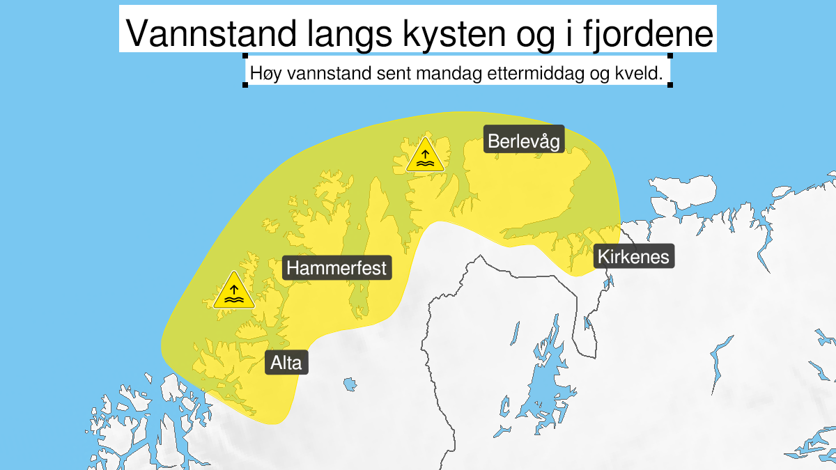
Warning from MET Norway for Kyst- and fjordstroekene i Finnmark
2
High water level, yellow level (MET)
Published:
Valid:
from 01.03.2021 14:00
to 01.03.2021 21:00
Warning
Water level at the coast and in the fjords
-
Sender: MET Norway
-
Danger ongoing: Monday, March 1, 2021, kl.2:00 PM
-
Danger decrease: Monday, March 1, 2021, kl. 9:00 PM
-
Certainty: Likely > 50%
Consequence
Wind and waves in combination with high water level may cause minor damage to infrastructure and buildings in the coastal zone.
Advice
Due to high waves be careful in coastal areas. Check the mooring of the boat and secure objects inside boathouses and in the coastal zone.
Description
Warning for the area Torsvaag to Russian Border: Monday afternoon and evening high water level is expected. More information about timing of high water level and values for positions along the coast at sehavniva.no. The uncertainty of the predicted water level is 5-10 cm.