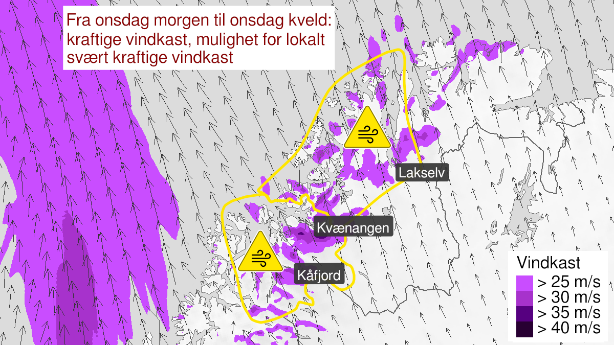
Warning from MET Norway for Nord-Troms and Kyst- and fjordstroekene i Vest-Finnmark
2
Strong wind gusts, yellow level (MET)
Published:
Valid:
from 22.09.2021 08:00
to 22.09.2021 20:00
Warning
Wind gusts
-
Sender: MET Norway
-
Danger ongoing: Wednesday, September 22, 2021, kl.8:00 AM
-
Danger decrease: Wednesday, September 22, 2021, kl. 8:00 PM
-
Certainty: Likely > 50%
Consequence
Loose items may be taken by the wind. Possibly cancelled departures for ferry, plane, or other transport. Bridges may be closed. Some journeys may have longer travel times. Some roads may be closed due to trees or other objects in the road. The strong wind may cause locally high waves in fjords and lakes.
Advice
Secure loose objects. Avoid unnecessary journeys to exposed places. Follow advice and check status from transport operators. Check road reports (175.no). In advance consider measures to limit damage.
Description
From Wednesday morning to Wednesday evening expected south and southeast severe gale force 9, and occasionally storm force 10 in exposed places. In conjunction with the strong wind there are expected severe gusts in the range of 25-33 m/s. There is also possibility for locally very severe gusts in the range of 33-37 m/s. The strongest gusts are expected at exposed places between Lyngsalpan and Porsanger, but the very severe gusts are not expected to affect populated areas. There is also expected that many areas will not be affected by the severe gusts at all, and it is unpredictable where the strongest wind will burst down from higher elevations and where the wind will blow over leaving the lower areas unaffected.