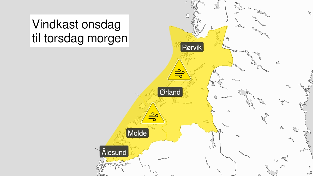
Warning from MET Norway for Moere and Romsdal and Troendelag
2
Strong wind gusts, yellow level (MET)
Published:
Valid:
from 12.01.2022 07:00
to 13.01.2022 10:00
Warning
Wind gusts
-
Sender: MET Norway
-
Danger ongoing: Wednesday, January 12, 2022, kl.7:00 AM
-
Danger decrease: Thursday, January 13, 2022, kl. 10:00 AM
-
Certainty: Likely > 50%
Consequence
Loose items may be taken by the wind. Possibly cancelled departures for ferry, plane, or other transport. Bridges may be closed. Some journeys may have longer travel times. The power supply may be impacted, due to tree(s) falling over. Some roads may be closed due to trees or other objects in the road. High waves may cause damage to infrastructure and buildings in the coastal zone. The strong wind may cause locally high waves in fjords and lakes.
Advice
Secure loose objects. Avoid unnecessary journeys to exposed places. Follow advice and check status from transport operators. Check road reports (175.no). Be careful in coastal areas. In advance consider measures to limit damage.
Description
Wednesday and early Thursday morning southwest severe gale force 9 to storm force 10 is expected, with local strong gusts of 30-35 m/s. The wind is strongest in coastal areas, and the strongest wind is moving northwards during Wednesday afternoon. Thursday morning decreasing.