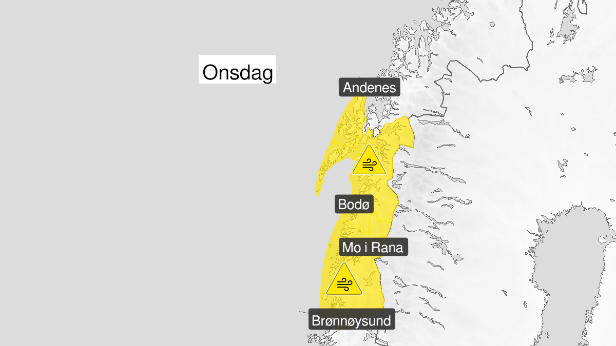
Warning from MET Norway for Nordland
2
Strong wind gusts, yellow level (MET)
Published:
Valid:
from 12.01.2022 04:00
to 13.01.2022 04:00
Warning
Wind gusts
-
Sender: MET Norway
-
Danger ongoing: Wednesday, January 12, 2022, kl.4:00 AM
-
Danger decrease: Thursday, January 13, 2022, kl. 4:00 AM
-
Certainty: Likely > 50%
Consequence
Loose items may be taken by the wind. Possibly cancelled departures for ferry, plane, or other transport. Bridges may be closed. Some journeys may have longer travel times. The power supply may be impacted, due to tree(s) falling over. Some roads may be closed due to trees or other objects in the road. Blowing snow at higher altitudes causes reduced visibility and possibly convoys and/or closed roads. High waves may cause damage to infrastructure and buildings in the coastal zone. The strong wind may cause locally high waves in fjords and lakes.
Advice
Secure loose objects. Avoid unnecessary journeys to exposed places. Check road reports (175.no). Be careful in coastal areas. In advance consider measures to limit damage.
Description
Early Wednesday morning increasing to southwest occasionally storm force 10 with locally windgusts between 30-35 m/s. From Wednesday afternoon veering west.