Warning from MET Norway for Outer Vestfjord, Roest Bank, Vesteraalbanks, Banks outside Troms and Tromsoeflaket and Lofoten, Vesteraalen and Troms
2
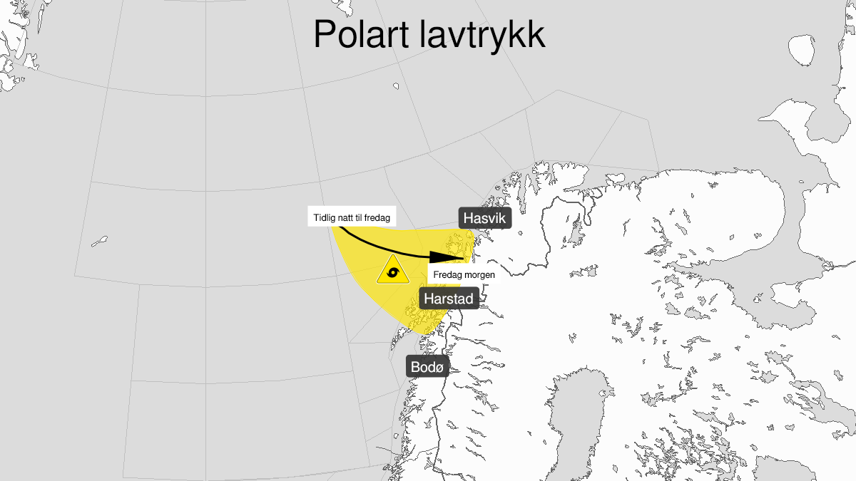
Polar low, yellow level (MET)
Published:
Valid:
from 28.01.2022 05:00
to 28.01.2022 11:00
Warning
Polar low
-
Sender: MET Norway
-
Danger ongoing: Friday, January 28, 2022, kl.5:00 AM
-
Danger decrease: Friday, January 28, 2022, kl. 11:00 AM
-
Certainty: Likely > 50%
Consequence
Abrupt change in wind speed and wind direction. It can be difficult to navigate due to snow, blowing snow and reduced visibility. Some journeys may have longer travel time. It can be locally difficult driving conditions due to heavy snowfall in combination with wind.
Advice
Be aware of abrupt weather changes. Avoid unnecessary journeys to exposed places. Consider whether the journey is necessary. Check road reports (175.no).
Description
A Polar low will early Friday morning develop in the sea areas west of Troms and is moving towards east. Friday morning the position is uncertain but its expected to make landfall between Lofoten and Tromsø. In western part of the low northwesterly gale force 8 or severe gale force 9 is expected. The low is weakening late Friday morning.