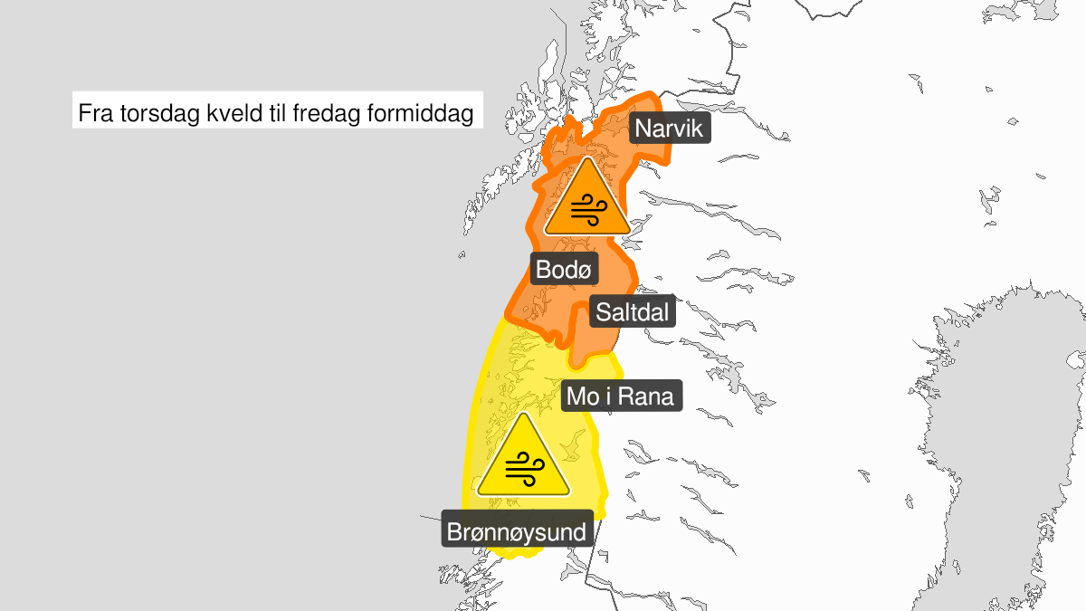
Warning from MET Norway for Helgeland
2
Strong wind gusts, yellow level (MET)
Published:
Valid:
from 03.02.2022 19:00
to 04.02.2022 10:00
Warning
Wind gusts
-
Sender: MET Norway
-
Danger ongoing: Thursday, February 3, 2022, kl.7:00 PM
-
Danger decrease: Friday, February 4, 2022, kl. 10:00 AM
-
Certainty: Likely > 50%
Consequence
Loose items may be taken by the wind. Possibly cancelled departures for ferry, plane, or other transport. Bridges may be closed. Some journeys may have longer travel times. The power supply may be impacted, due to tree(s) falling over. Some roads may be closed due to trees or other objects in the road. Blowing snow at higher altitudes causes reduced visibility and possibly convoys and/or closed roads. Blowing snow causes reduced visibility and possibly convoys and/or closed roads. High waves may cause damage to infrastructure and buildings in the coastal zone. The strong wind may cause locally high waves in fjords and lakes.
Advice
Secure loose objects. Avoid unnecessary journeys to exposed places. Follow advice and check status from transport operators. Check road reports (175.no). Be careful in coastal areas. In advance consider measures to limit damage.
Description
From Thursday evening expected southeast severe gale force 9 in exposed places with locally strong gust 27-35 m/s. Decreasing wind late Friday morning.