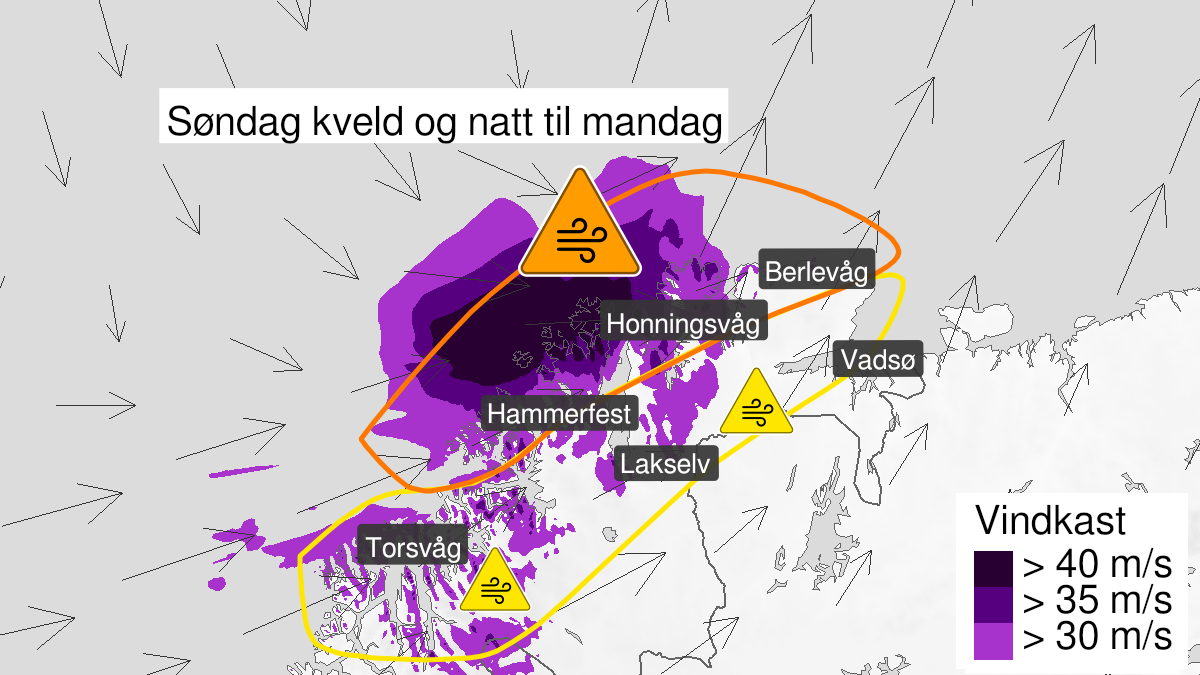
Warning from MET Norway for Nord-Troms, Fjordstrøkene i Vest-Finnmark and Fjordstrøkene i Øst-Finnmark
2
Strong wind gusts, yellow level (MET)
Published:
Valid:
from 27.02.2022 18:00
to 28.02.2022 05:00
Warning
Wind gusts
-
Sender: MET Norway
-
Danger ongoing: Sunday, February 27, 2022, kl.6:00 PM
-
Certainty: Likely > 50%
Consequence
Loose items may be taken by the wind. Possibly cancelled departures for ferry, plane, or other transport. Bridges may be closed. Some journeys may have longer travel times. Blowing snow causes reduced visibility and possibly convoys and/or closed roads. The strong wind may cause locally high waves in fjords and lakes.
Advice
Secure loose objects. Avoid unnecessary journeys to exposed places. Follow advice and check status from transport operators. Check road reports (175.no). Be careful in coastal areas. In advance consider measures to limit damage.
Description
Sunday evening and early Monday morning west storm force 10 in exposed places with locally severe wind gusts of about 30-38 m/s. In addition, there will be rain showers and becoming wintry showers during early Monday morning.