Warning from MET Norway for Kyst- and fjordstroekene i Finnmark
3
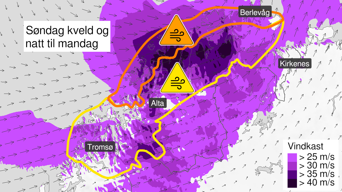
Very strong wind gusts ongoing, orange level (MET)
Published:
Valid:
from 27.02.2022 20:00
to 28.02.2022 03:00
Warning
Wind gusts
-
Sender: MET Norway
-
Danger ongoing: Sunday, February 27, 2022, kl.8:00 PM
-
Certainty: Observed - 100%
Consequence
Larger loose items may be taken by the wind. Risk of damage to buildings and infrastructure. Cancelled departures for ferry, plane, or other transport expected. Bridges may be closed. Many journeys may have longer travel times. The power supply will be impacted, due to tree(s) falling over. Roads may be closed due to trees or other objects in the road. Blowing snow causes reduced visibility and possibly convoys and/or closed roads. High waves may cause damage to infrastructure and buildings in the coastal zone. The strong wind may cause locally high waves in fjords and lakes.
Advice
Secure all loose objects. Avoid exposed places. Allow a lot of extra time for transportation and driving. Consider whether the journey is necessary. Follow advice and check status from transport operators. Check road reports (175.no). The need for emergency preparedness shall be assessed continuously by emergency response actors. Be careful in coastal areas. In advance consider measures to limit damage.
Description
Sunday evening and early Monday morning expected west violent storm force 11 to hurricane in exposed places with very severe wind gusts of about 38-43 m/s locally. Extreme wind gusts of above 43 m/s are expected along the coast. Observations wind gusts Sunday evening in m/s: Hekkingen lighthouse (Troms) 46,0, Fakken (Troms) 44,9, Melkøya 43,6, Rognsundet 43,2, Torsvaag lighthouse (Troms) 40,8, Hammerfest lufthavn 40,5. In combination with westerly winds there might be a significant waveheight of about 6-10 meter along the coast. In addition there will be rain showers, and becoming wintry showers during early Monday morning.