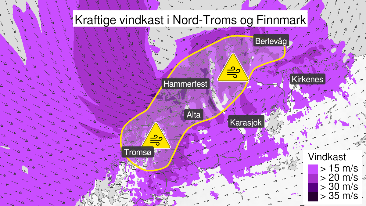
Warning from MET Norway for Nord-Troms and Kyst- and fjordstroekene i Finnmark
2
Strong wind gusts, yellow level (MET)
Published:
Valid:
from 07.05.2022 13:00
to 08.05.2022 04:00
Warning
Wind gusts
-
Sender: MET Norway
-
Danger ongoing: Saturday, May 7, 2022, kl.1:00 PM
-
Danger decrease: Sunday, May 8, 2022, kl. 4:00 AM
-
Certainty: Likely > 50%
Consequence
Bridges may be closed. Blowing snow at higher altitudes causes reduced visibility and possibly convoys and/or closed roads. Blowing snow causes reduced visibility and possibly convoys and/or closed roads. The strong wind may cause locally high waves in fjords and lakes.
Advice
Follow advice and check status from transport operators. Check road reports (175.no). Be careful in coastal areas. In advance consider measures to limit damage.
Description
From Saturday afternoon wind gusts from the west and northwest up to 30-35 m/s is expected in Northern Troms and in coastal and fjord areas in Finnmark. Possibly extreme wind gusts in West-Finnmark up to 35-40 m/s. West strong gale force 9 is expected in West-Finnmark, possibly locally up to storm force 10 m/s in exposed places. The wind decreases in Northern Troms during afternoonen or evening, and in Finnmark early Sunday morning.