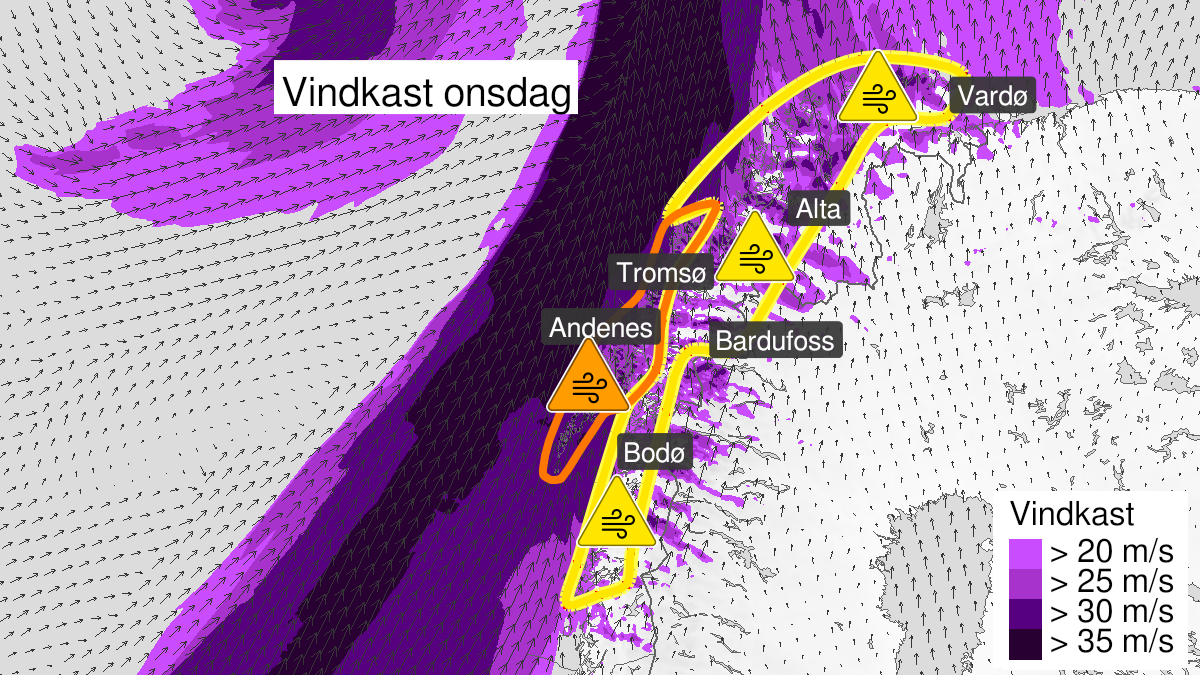
Warning from MET Norway for Lofoten, Vesterålen and coastal areas in Troms
3
Very strong wind gusts ongoing, orange level (MET)
Published:
Valid:
from 08.02.2023 13:00
to 09.02.2023 01:00
Warning
Wind gusts
-
Sender: MET Norway
-
Danger ongoing: Wednesday, February 8, 2023, kl.1:00 PM
-
Danger decrease: Thursday, February 9, 2023, kl. 1:00 AM
-
Certainty: Observed - 100%
Consequence
Larger loose items may be taken by the wind. Risk of damage to buildings and infrastructure. Cancelled departures for ferry, plane, or other transport expected. Bridges may be closed. Many journeys may have longer travel times. The power supply will be impacted, due to tree(s) falling over. Roads may be closed due to trees or other objects in the road. High waves may cause damage to infrastructure and buildings in the coastal zone. The strong wind may cause locally high waves in fjords and lakes.
Advice
Secure all loose objects. Avoid exposed places. Allow a lot of extra time for transportation and driving. Consider whether the journey is necessary. Follow advice and check status from transport operators. Check road reports (175.no). The need for emergency preparedness shall be assessed continuously by emergency response actors. Be careful in coastal areas. In advance consider measures to limit damage.
Description
Until Wednesday at 1 PM there are observed wind gusts of 32 to 42 m/s in the affected area. During Wednesday afternoon and evening there are still expected south-southwesterly storm and violent storm in exposed places with locally very severe wind gusts of 30-40 m/s. In Vestfjorden, and the outer parts of Lofoten, Vesteraalen and Troms there are expected significant wave heights of 8-12 meter. The wind is expected to decrease late Wednesday evening, and the waves during early Thursday morning.