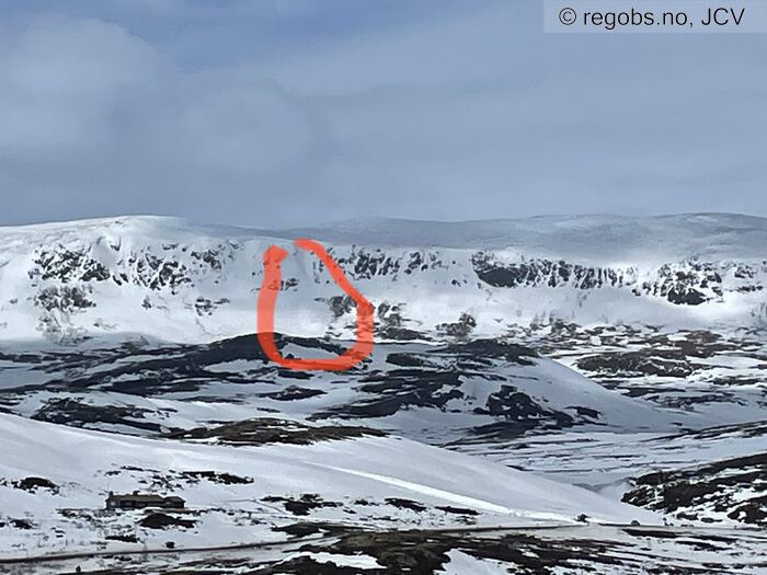
Image 1 of 6 Of: Avalanche Activity Copyright: JCV Comment: Bergsjøstølen ligger 100 m til høyre for bildets nedre høyre hjørne.
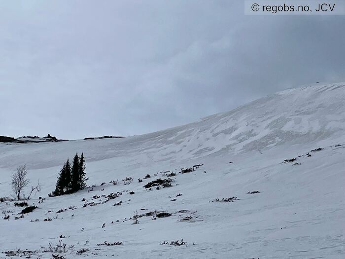
Image 2 of 6 Of: Snow Cover Copyright: JCV Comment: Tydelige felter med hvit nysnø. Bilde 1 av 2 av dette henget. Tatt mot VSV.
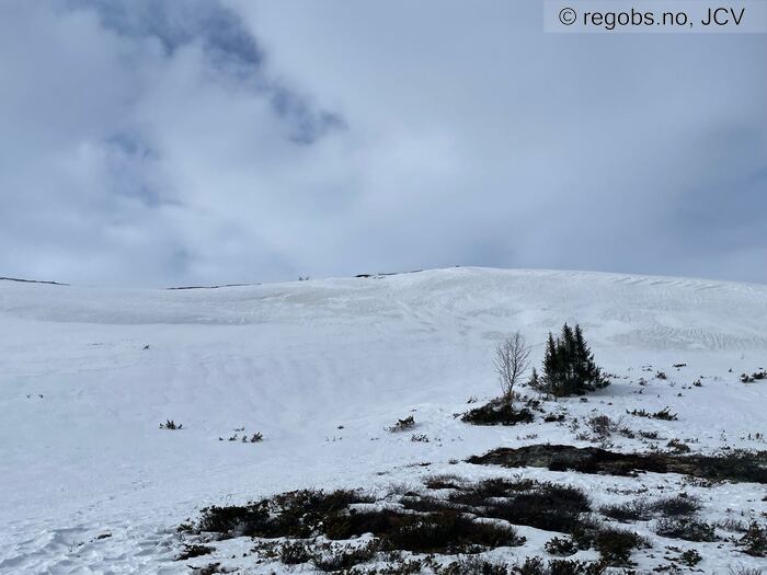
Image 3 of 6 Of: Snow Cover Copyright: JCV Comment: Bilde 2 av 2 av samme heng. Tatt mot VNV.
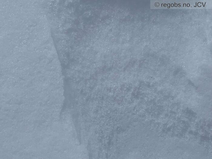
Image 4 of 6 Of: Snow Cover Copyright: JCV Comment: Tydelig rimdanbelse i høyre del av bildet.
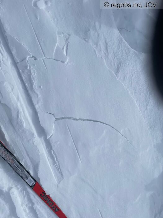
Image 5 of 6 Of: Snow Cover Copyright: JCV Comment: Brudd i et av nysnøfeltene. Denne flekken er 10-15 cm på det tykkeste.
Bruddet kom etter lite belastning, som passer godt m testen steinar@regobs gjorde i samme område i går.
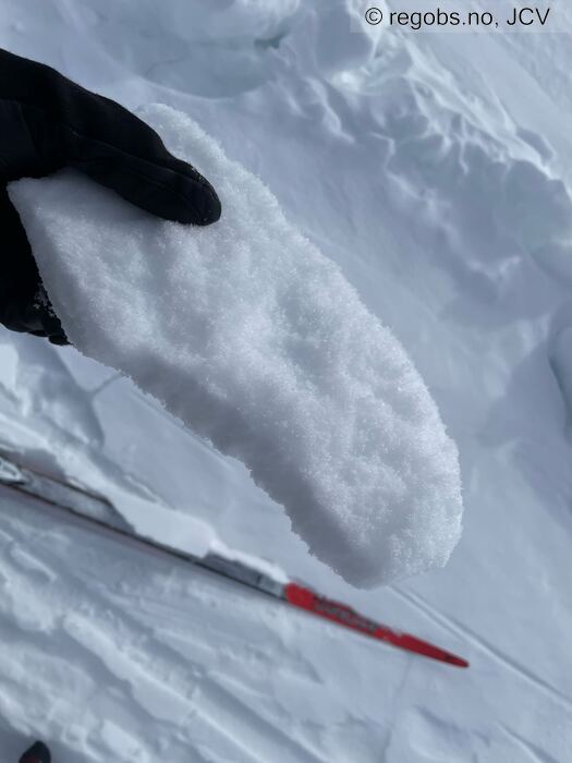
Image 6 of 6 Of: Snow Cover Copyright: JCV Comment: Del av bruddflaten på forrige bilde. Flaket ca 5 cm tykt, bruddflate Q2.
Avalanche Activity
• 7. Apr. 18-24 • Dry slab avalanche • One (1). 3 - Large. Spontaneous release • Few steep slopes. SE, S, SW. Above 1400 masl • Relativt stort skred i Reineskarvet, omtrent midtveis mellom Eitre og Reine, anslått inntil 150 m bredt. Steinar@regobs melde ingen aktivitet i går, så dette må ha gått ut siste døgn. Mitt observasjonspunkt var på skiløypa rett nord for Vardehovda.
Weather
• No precipitation • 1 °C • 8 m/s from NE ↙ • 50% clouds • Sløret skydekke. Ingen nedbør siste døgn til tross for varslet mulig inntil 5-10 cm.
Noe snøtransport.
Snow Cover
• 50 cm • No snowdrift • 0 cm • Snow line at 600 masl. Layered snow begins at 800 masl • Some loose snow (1-10cm) • Dry • Observasjonen steinar@regobs gjorde i går (6.4) er presis.
Nedbøren som kom mandag-tirsdag er transportert og samlet i mindre felt, på flatmark så vel som i sø-heng. Disse feltene er av varierende størrelse, fra <1m2, til over 100 m2, og det kan være flere av dem i samme heng, både over/under hverandre og i side. Snøen som er pakket i disse feltene er ganske kompakt, og har kornstørrelse <1mm. Dersom det kommer nedbør av betydning vil disse feltene kunne medvirke til at skredfaren kan variere innad i samme heng.
I tillegg er det dannet rim i enkelte, men ikke alle, feltene.
I tillegg er noen delvis lagdelt, med lag mellom 2 og 5 cm.
Avalanche Problems
• Dry slab avalanche • Buried weak layer of faceted snow above a crust • Within half a meter • The collapsing weak layer is thin < 3 cm. • Easy to trigger • 1 - Small • E, SE, S above 1000 masl
Avalanche Danger Assessment
• I større leheng mot SØ vil det øverste tynne laget kunne løsne ved bare liten belastning (skiløper). • Nåværende nysnøfelter vil, etter ny nedbør, kunne gi varierende skredfare innad i ett og samme heng. • 1 Low • Forecast correct

