Image 1 of 9 Of: Snow Cover Copyright: CatoLeganger@obskorps
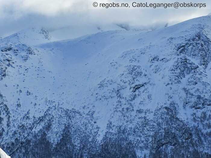
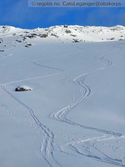
Image 2 of 9 Of: Snow Cover Copyright: CatoLeganger@obskorps Comment: Normalruta mot Omnatind 1360 moh. Ryggen i midten ligg på ca 1000 moh. Vestvendt.
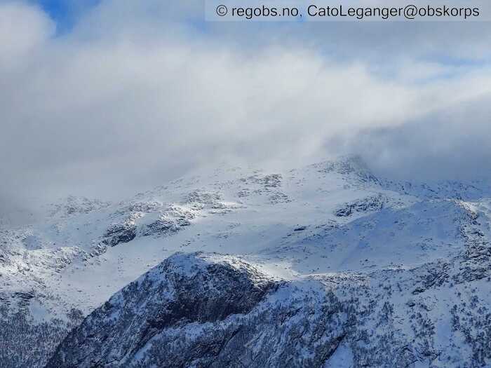
Image 3 of 9 Of: Snow Cover Copyright: CatoLeganger@obskorps Comment: Mildværet har tært mykje på snødekket, men med litt påfyll ifm vindtransport og nysnø siste 12t fører til fint skiføre. Mot aust.
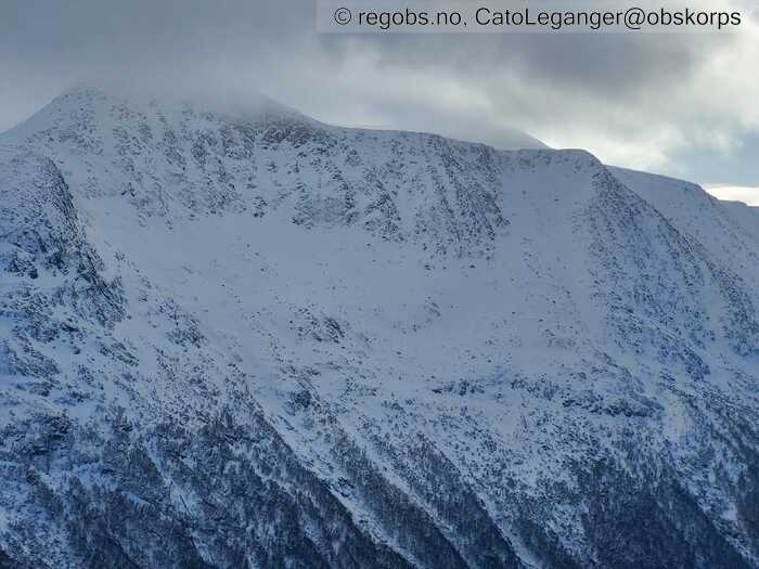
Image 4 of 9 Of: Snow Cover Copyright: CatoLeganger@obskorps Comment: Bratte vestvendte sider.
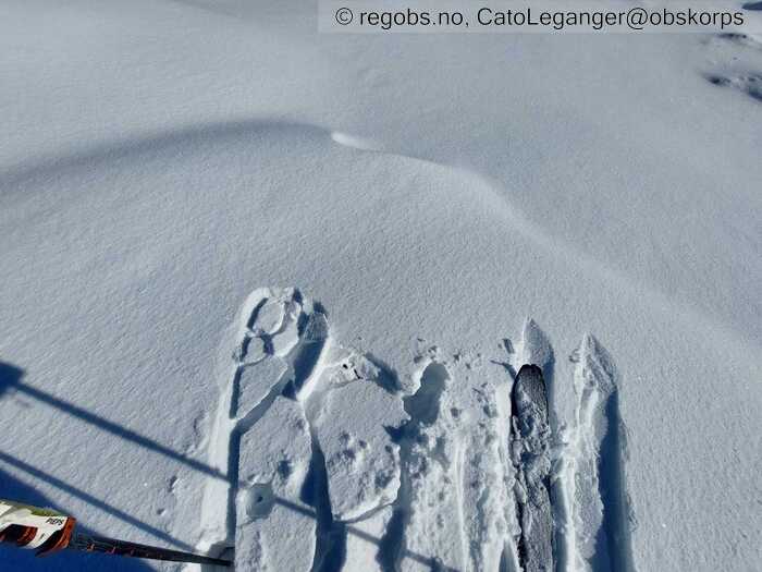
Image 5 of 9 Of: Snow Cover Copyright: CatoLeganger@obskorps Comment: Mjuke flak mot sør. Meir bunden lagdeling djupare i snødekket.
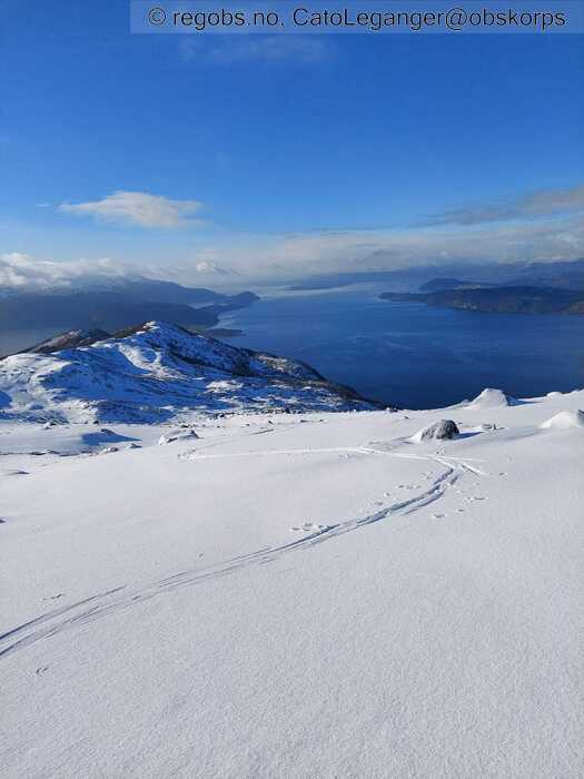
Image 6 of 9 Of: Snow Cover Copyright: CatoLeganger@obskorps Comment: Mot sørvest. Ca 750 moh.
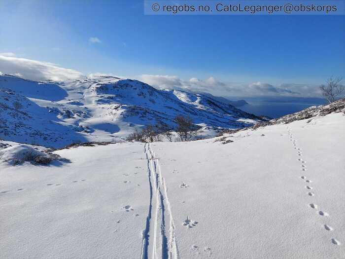
Image 7 of 9 Of: Weather Copyright: CatoLeganger@obskorps Comment: Mot sør. 660 moh. Litt meir tilskyende utover dagen.
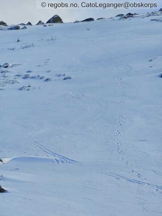
Image 8 of 9 Of: Snow Cover Copyright: CatoLeganger@obskorps Comment: Der nordvesten har fått ekstra tak er det, til dels, avblåst til nedpå skaren. Ligger ein halv cm styresnø oppå, men jamt over hardt.
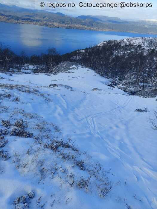
Image 9 of 9 Of: Snow Cover Copyright: CatoLeganger@obskorps Comment: Ikkje det heilt store skiføret ved skoggrensa, vestvendt og fjordnært, men det funkar både opp og ned. Betre føre/meir snø i tilsvarande formasjonar som ikkje ligger ved fjorden.
Danger Sign
• No signs observed • Område: Generelt på fjellet. Skildring: Har hatt grei utsikt til høgareliggande terreng, og eg kan ikkje sjå teikn til skred eller snøfokk av betydning i skrivande stund.
Avalanche Activity
• 18. Feb. During the day (+01:00) • No avalanche activity
Weather
• No precipitation • -3 °C • 4 m/s from NW ↘ • 40% clouds • Det er i skrivande stund vind som kan gi lokalt lett snøfokk, men det er relativt avblåst i terreng som ligg utsatt til for transport. Må evt avvente til vinden dreier eller at det byrjar å falle snø igjen.
Klarere og roligere vêrtype frå i natt og utover dagen i dag. Tilsynelatende litt meir vind i indre del av regionen, men det er obs kun basert på gjennomgang av vær webkamera o.l. i dag tidleg.
Snow Cover
• 70 cm • No snowdrift • Elevation of new snow 400 masl. Snow line at 500 masl. Layered snow begins at 600 masl • Some loose snow (1-10cm) • Dry • Good • Varierende grense for samanhengande skiføre i regionen. Varierer frå 400 moh til 600-700 moh.
Ganske avblåst på ryggar og konvekser i høgda. Litt tørr lausnø over skare mot vest og nordvest. Fokksnøflak med litt laussnø over mot sør og søraust.
Tests
• ECTP12@18cm(Q2) • Medium • Dårlig binding innad i fokksnøen/tendens til innslag av delvis nedbrutt nysnø.
Snow Profile
• SE • 15° • 4 Stratigraphy layers
Avalanche Problems
• Dry slab avalanche • Poor bonding between layers in wind deposited snow • Within half a meter • The weak layer collapses easily and clean (easy propagation). The collapsing weak layer is thin < 3 cm. The overlying slab is soft. A big and identifiable crystal in the weak layer. • Easy to trigger • 2 - Medium • Some steep slopes E, SE, S above 800 masl • Det varierer nok ein del kor potent problemet er i regionen, spesielt i lågareliggande skredterreng, men vil uansett anta at innmeldt utbreiing er representativt for regionen sett under eitt.
Avalanche Danger Assessment
• Ver varsom i formasjonar som har samla fersk fokksnø. Det er lett å løyse ut skred, og skreda kan verte store nok til å begrave deg. • Det skal fortsetje å blåse frå nord-nordvest fram til i morgon ettermiddag. Dreiande vindretning frå kvelden av, men minkande i styrke. Frå natt til måndag skal vinden igjen dreie, no frå vest-nordvest, og vinden tek seg opp igjen i styrke. I følgje vêrprognosane så skal det falle mykje nedbør dei neste 48 timane, spesielt på måndag. I kombinasjon med kraftig vind, så kan vi få ein forsterka (FG 3) på måndag. Temperaturen skal litt opp, ifht i dag og sundag, så det vil vere litt gunstigare forhold for stabilisering av ferske fokksnøflak. Fallande skredfare frå tysdag av. Det vil nok vere ein del variasjon i regionen. • 2 Moderate • Forecast correct

