Image 1 of 7 Of: Tests Copyright: Even@obskorps
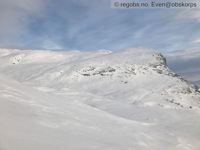
Image 2 of 7 Of: Snow Cover Copyright: Even@obskorps
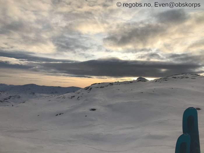
Image 3 of 7 Of: Weather Copyright: Even@obskorps Comment: Mot bitihorn
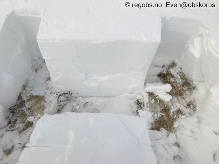
Image 4 of 7 Of: Tests Copyright: Even@obskorps
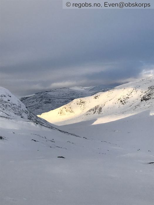
Image 5 of 7 Of: Snow Cover Copyright: Even@obskorps Comment: Vindherja vestover mot Søre Kalvehølotind
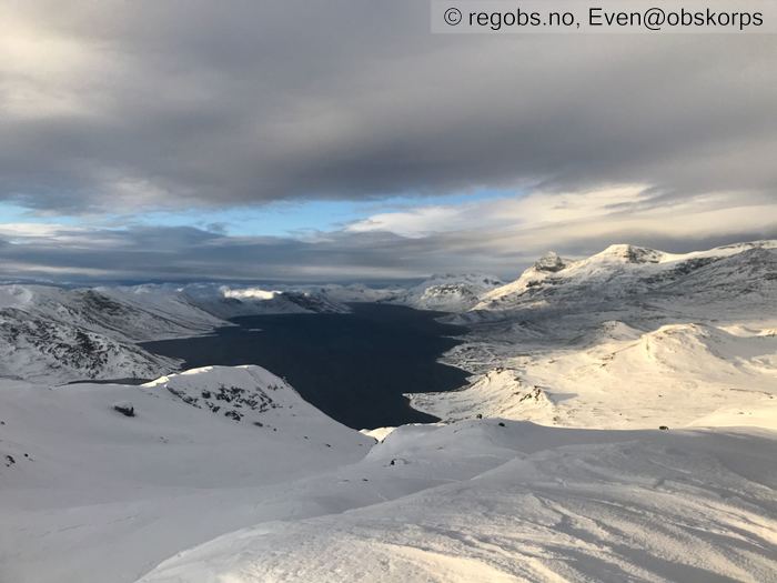
Image 6 of 7 Of: Weather Copyright: Even@obskorps Comment: Bygdin vestover
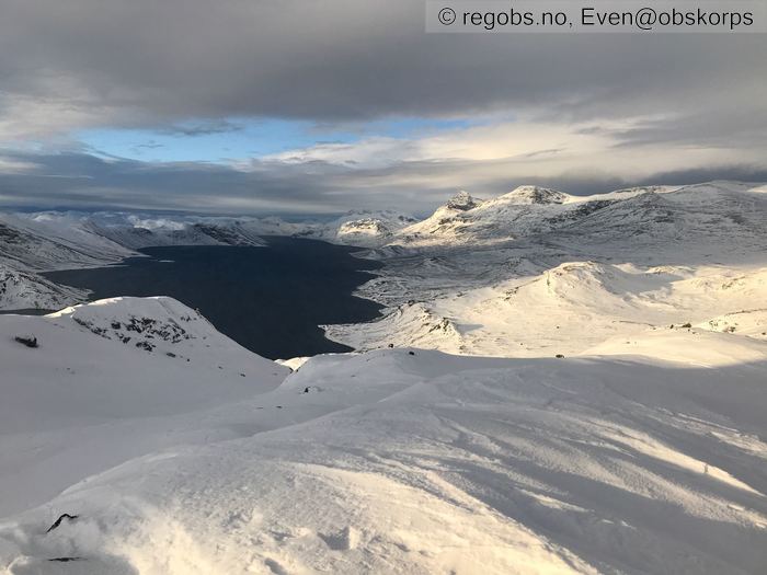
Image 7 of 7 Of: Snow Cover Copyright: Even@obskorps Comment: Bygdin vestover
Danger Sign
• No signs observed • Område: I denne fjellsiden
Avalanche Activity
• 4. Dec. During the day (+01:00) • No avalanche activity
Weather
• No precipitation • 2.4 °C • 13 m/s from W → • 60% clouds • Mildvær med inversjon. -grader i dalen fra morran. Mye vind fra vest og skyet oppholdsvær. Et kaldt snødekke kan tyde på en klarværsnatt
Snow Cover
• 80 cm • No snowdrift • 0 cm • Wind slab (hard slab) • Moist • Varierende hardhet etter mye vindherjing. Bærende vindskare til F fuktig snø rett til bakken. Fortsatt et kaldt snødekke med intakte lagdelinger. Kantkorn er fortsatt gjeldende i dette området. Kantkorn over skare dukket opp på omlag 1300 moh. På 1200 fant jeg kun kantkorn ved bakken. Ellers et varierende dekke med mye vindpreg.
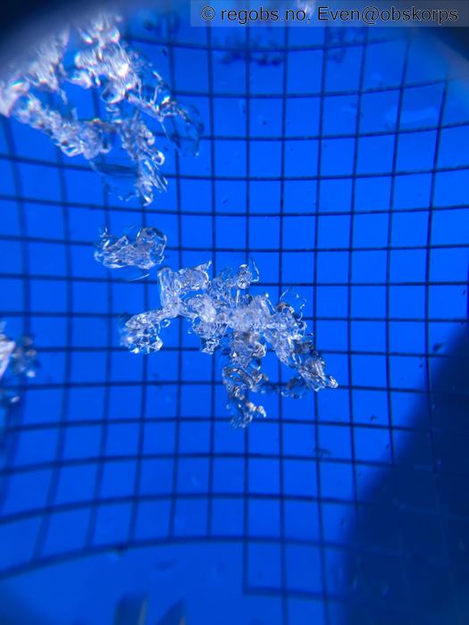
Tests
• LBT@62cm(Q2) • På kant/beger på bakken
• ECTP11@62cm(Q2) • Medium • Kant/beger ved bakken. God forplantning. Kom ut med en god whoomp lyd
Snow Profile
• Persistent weak layer: thin layer, below slab, near surface • 6 temperature points observed
Avalanche Problems
• Dry slab avalanche • Buried weak layer of faceted snow near the ground • The weak layer collapses easily and clean (easy propagation). The collapsing weak layer is thin < 3 cm. A big and identifiable crystal in the weak layer. • Difficult to trigger • 2 - Medium • Some steep slopes N, NE, E, SE, S, SW, W, NW above unknown masl
• Dry slab avalanche • Buried weak layer of faceted snow above a crust • Within half a meter • The weak layer collapses easily and clean (easy propagation). The collapsing weak layer is thin < 3 cm. A big and identifiable crystal in the weak layer. • Difficult to trigger • 2 - Medium • Some steep slopes N, NE, E, SE, S above 1000 masl
Avalanche Danger Assessment
• Kantornproblematikken vedvarer i fjellet. Vinden har herja bra i fjellet. Snøen har fokka seg og dannet flak av ulik hardhet i ulike himmelretninger. Skredproblemet gav ingen signaler i dag. Dette pga et relativt hardt snødekke over svake lag.Påvirkning vil være mulig av skiløper på tynnere snødekke. Fjernutløsning vil være mulig. Skredstørrelse vil begrenses av størrelse på flak. I dette området ikke større enn 2. Varmere vær preger snøoverflaten, men dypere ned i dekke er det fortsatt kulde og tendens til en god gradient mtp omdanning. • Det ventes mye vind i kominasjon med nedbør. Dette vil gi en økende belastning på snødekket og en økende fare for skredutløsing. Sjiktovergang og nedføyket nysnø vil bli aktuelle skredproblemer i tillegg til de(t) vedvarende svake lagene. • 3 Considerable • Forecast correct

