Hardanger / Ullensvang
CatoLeganger@obskorps (****)
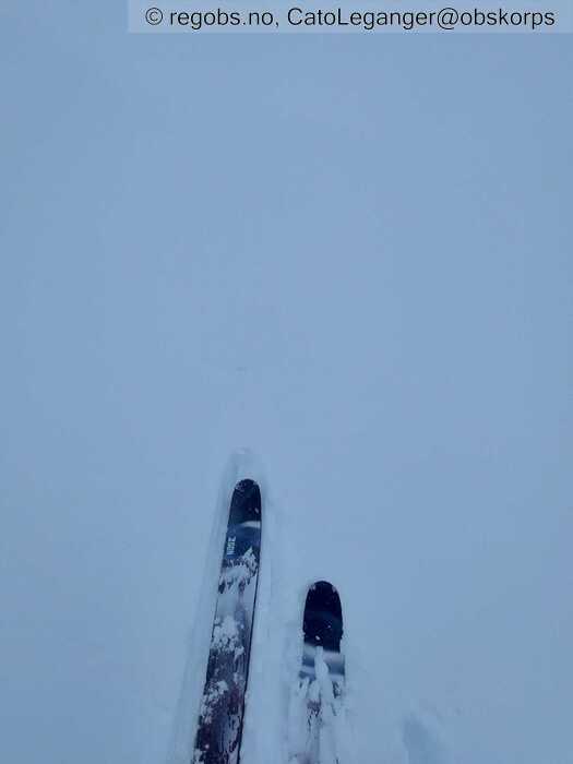
Image 1 of 3 Of: Snow Cover Copyright: CatoLeganger@obskorps Comment: Ubunden snø over vindtransportert snø. Mot søraust.
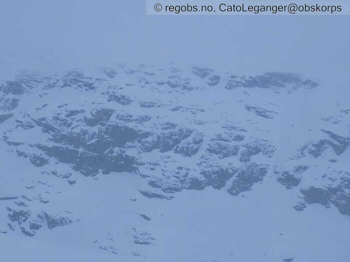
Image 2 of 3 Of: Snow Cover Copyright: CatoLeganger@obskorps Comment: Høg skredaktivitet i fjellsidene rundt Håradalen.
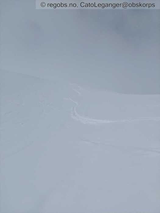
Image 3 of 3 Of: Snow Cover Copyright: CatoLeganger@obskorps Comment: Fint skiføre, spesielt tidleg på dag. Tyngre snø etter kvart som temperaturen steig.
Danger Sign
• Recent avalanches • Område: I denne fjellsiden. Beskrivelse: Område: I denne fjellsida. Skildring: Tidleg på dag: Eg ser det ikkje pga redusert sikt, men eg høyre det går skred i tilknytning til bratte skrenter.
Oppdatert: Observerte mange str. 1 skred - primært naturleg utløyst, men truleg også utløyst av skilauparar. Kunne ane tendensane til eit flakskred av str. 1,5ish mot søraust. Mogleg utløyst av skilaupar.
Avalanche Activity
• 1. May. During the day • Loose dry avalanche • Numerous (10 or more). 1 - Small. Spontaneous release • Some steep slopes. N, NE, E, SE, S, SW, W, NW. Above 800 masl • Tendenserte nok til våte laussnøskred utover dagen. Buldra og braka godt i fjellsidene - spesielt i fjellsider med mange klipper.
• 1. May. During the day • Dry slab avalanche • One (1). 1 - Small • Few steep slopes. SE. Between 1000 masl and 800 masl • Str. 1+, men litt vanskeleg å sjå pga anna skredaktivitet.
Snow Cover
• 200 cm • No snowdrift • 10 cm • Elevation of new snow 300 masl. Snow line at 600 masl. Layered snow begins at 600 masl • Much loose snow (10-30cm) • Dry • Very Good • Tørr nysnø i alle himmelretningar i dag tidleg. Stigande temp og glytt av sol utover dagen gjorde overflata meir kram og tung. Fokksnø, under dagens nysnø, mot sør-søraust-aust etablert i helga. Relativt stabilt, men i enkelte heng la fokksnøen seg over eit tynnare lag av nysnø. Her vil det vere lettare å løyse ut skred. Stort sett smelteomvandla snø under dette. Det kan henge att sterkt avrunda kant i skjerma formasjonar mot nord, men eg har ikkje fått sitt etter dette i dag. Uansett vil det vere svært vanskeleg å påvirke.
Kan vere obs på at det er ein del skavlar som framleis er intakte.
Weather
• Snow • -0.5 °C • 4 m/s from NW ↘ • 100% clouds • Har falle 5-10 cm nysnø i natt. Som snø over 300 moh. Ikkje vind av betydning tidleg på dag, måndag.Stigande temp i skrivande stund: kl. 12-13. Kjenner eit mildare drag i lufta. Snødekket bere preg av det. Avtagande nedbør.
Tests
• ECTN4@15cm(Q3) • Medium • Nysnø.
• ECTN19@34cm(Q3) • Good • Fokksnø (delvis nedbrutt nysnø nedst) over smelteomvandla snø. Bunde seg godt her eg er, men det kan framleis vere mogleg å løyse ut mindre skred på det. Spesielt i bratt terreng. Observerte i dag enkelte mindre flakskred på konvekser.
Snow Profile
• SE • 20° • 5 Stratigraphy layers • 6 temperature points observed
Avalanche Problems
• Loose dry avalanche • Loose snow • Spontaneous release • 1 - Small • Some steep slopes N, NE, E, SE, S, SW, W, NW above 600 masl • Våte laussnøskred om sola kjem fram og får tak. Kanskje str. 2 i få heng. Skredproblemet var tørt i dag tidleg. Overgang til vått utover dagen.
• Dry slab avalanche • Buried weak layer of new snow • Within half a meter • The overlying slab is soft. • Easy to trigger • 1 - Small • Some steep slopes E, SE, S above 900 masl • Kanskje str.2 i få heng. Legg det inn som eige problem. Antar at det er str. 1 - lett å løyse ut som er mest aktuelt. Mest aktuelt som våte flak dei neste dagane. Skredproblemet var tørt i dag tidleg.
• Dry slab avalanche • Buried weak layer of new snow • Within half a meter • The overlying slab is soft. • Easy to trigger • 2 - Medium • Few steep slopes E, SE, S above 800 masl • Skreda vil nok verte våte etter kvart som sola får tak. Tenker då for dei neste dagane. I dag tidleg var det mest aktuelt som tørt skredproblem.
Avalanche Danger Assessment
• Ver obs på ferdsel i- eller i nærleiken av terrengfeller. Det går naturlig utløyste tørre/våte laussnøskred. Tyngden i snøen og mengden snø som kan lausne vil kunne dra deg med. I enkelte utsatte formasjonar kan skreda verte store nok til å begrave deg. Ver spesielt varsom i nærleiken av bratte klipper - ikkje opphold deg der lengre enn høgst nødvendig. • Varmt på dagen og kaldt på natta. Kan kanskje vere litt obs på at det i enkelte skjerma formasjonar mot nord ligger fuktig snø med tørr snø over. Tysdag/onsdag skal det vere relativt låg temp, før det skal stige utover veka. • 2 Moderate • Forecast correct • Fornuftig med FG2 etter mykje vind i helga og ein del nysnø ila siste 24 timar. Relativt høg skredaktivitet i dag.

