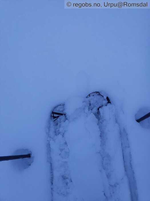
Image 1 of 6 Of: Danger Sign Copyright: Urpu@Romsdal Comment: Nesten sørpe overflate i skogen i ettermiddag
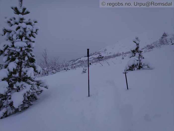
Image 2 of 6 Of: Snow Cover Copyright: Urpu@Romsdal Comment: Rundt 1 m snø nå.
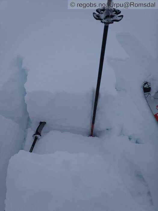
Image 3 of 6 Of: Tests Copyright: Urpu@Romsdal
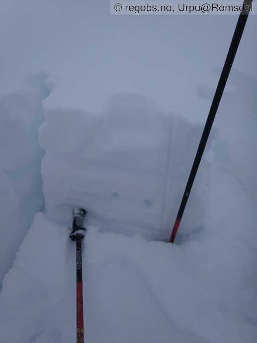
Image 4 of 6 Of: Snow Profile Copyright: Urpu@Romsdal Comment: Fra ca 820 SØ
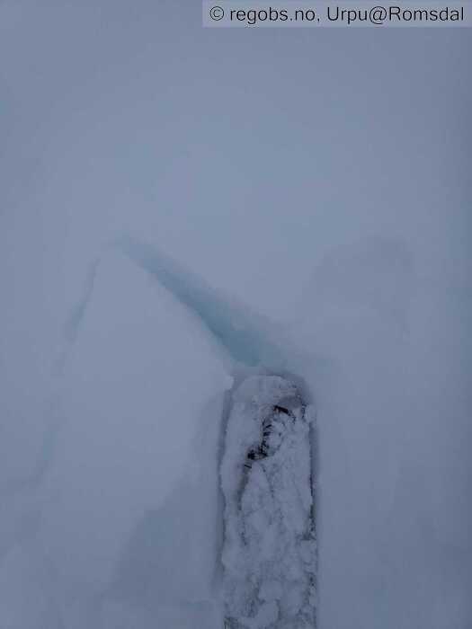
Image 5 of 6 Of: Avalanche Problems Copyright: Urpu@Romsdal Comment: Lett å tråkke ut mjuke flak der understøtten er borte.
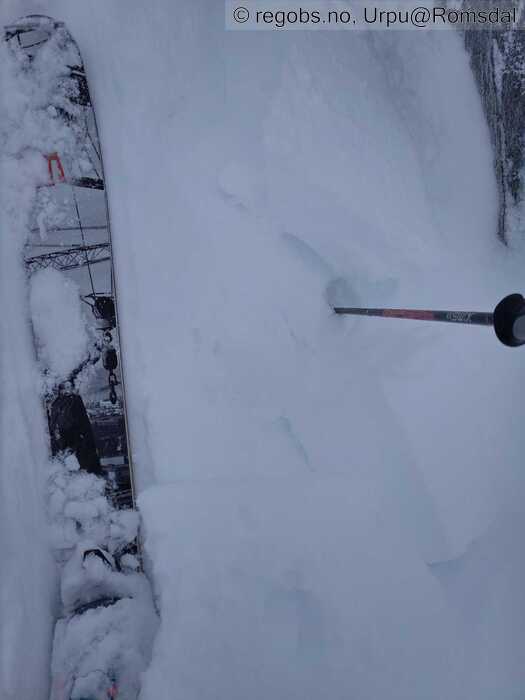
Image 6 of 6 Of: Avalanche Danger Assessment Copyright: Urpu@Romsdal Comment: Lett å tråkke ut flak på kanter, men lite eller ingen forplanting, bare klumper her.
Danger Sign
• Much water in the snow • Veldig vått overflate og smelteriller fra 500 og nedover i ettermiddag, regn på snø går oppover.
Avalanche Activity
• 21. Jan. During the day (+01:00) • For dårlig sikt til å observere over tregrensa. Gikk ihvertfall snøruller i takt med stigende temperatur og regn
Snow Cover
• 120 cm • Moderate snow drift • 30 cm • Elevation of new snow 0 masl. Snow line at 0 masl. Layered snow begins at 500 masl • Much loose snow (10-30cm) • Moist • Over ca 700 var det tørr nok overflate til at vinden kunne flytte snø, men nå ikveld og framover må en høyere opp for å finne tørr overflate . Ellers våt og meget våt overflate ned mot fjordnivå der det er blitt ganske bra sørpe.
Snøen fra onsdag og torsdag kom med en del vind, og er således ganske jevnt delt, men mest i sør og øst.
I skogen var det ca. 50-60 cm, men synker nå fort sammen.
Regnet fra tirsdag og natt til onsdag gikk opp til ca. 1200, og har mjuknet Gyda-skare og underliggende smelteomvandlet ihvertfall opp til denne høyden jeg gikk i dag (ca 800), så forventer nokså bra drenering i snødekke .
Tests
• LBT@12cm(Q3) • Nedføyket nysnø svikter ganske lett.
• LBT@35cm(Q2) • Nedføyket F nysnø svikter med middels tilleggslast, over er det 1-4F vindpakka flak.
Snow Profile
• SE • 20° • Fra ca.820 • 7 Stratigraphy layers • 7 temperature points observed
Avalanche Problems
• Dry slab avalanche • Buried weak layer of new snow • Within a meter • The overlying slab is soft. A big and identifiable crystal in the weak layer. • Easy to trigger • 3 - Large • Some steep slopes N, NE, E, SE, S above 700 masl • Kunne kanskje også vært str 2 . Etterhvert nå med stigende temps og regn vil det kunne gå våte flakskred, disse vil kunne gå lettere/ naturlig.
Ellers våte løssnøskred i alle himmelretninger under nullgrense.
Avalanche Danger Assessment
• Regn og plussgrader opp til 7-800 i dag på torsdag, høyere opp nå i kveld og framover ser ut som. Etter regnvær på tirsdag og natt til onsdag ble det kaldere vær med snøbyger fra nordvest. Temperaturen sank kraftig og fort ila onsdagen. Det kom vel opp mot en halvmeter snø. Nå er det altså mildvær igjen. Nok snø til å bli str 3 skred, kanskje i noen heng. Vil tru skredaktivitet er avhengig av mengde nedbør , og regn, og hvor fort temperaturen stiger. Ganske krevende situasjon i fjellet nå med endringer fra dag til dag • Stigende med nedbør som regn på kald snø, og plussgrader. Men ikke sikkert det blir så dramatisk da det ikke er meldt så mye regn. Mest bare vind og temperaturstigning . Over nullgrense er det full vinter, mye snø, føyk og ganske andre forhold enn under nullgrense. • 3 Considerable • Forecast correct • Bra. Eventuell kantkorn over Gyda-skare ble nok ødelagt opp til 11-1200 i mildværet på tirsdag&onsdag. Men det rakke kanskje danne litt på nytt på onsdagskvelden da temperaturen falt mye og fort. Nå blir den nok ødelagt igjen opp til plussgrade-høyde.

